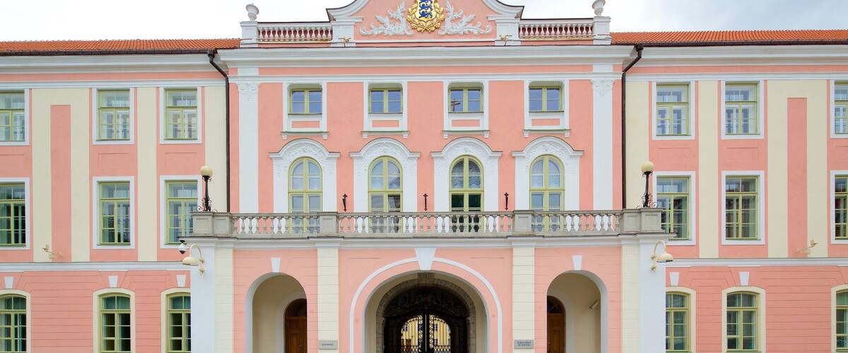
Toompea Castle
This historic fortress serves as the seat of the Parliament of Estonia. It features a pink baroque facade and the Tall Hermann tower.
View the castle exterior from the adjacent Governor's Garden.

Tallinn's compact medieval centre is built for walking, and a reliable map turns a wander into a purposeful route. Print-ready PDFs with marked waypoints let you navigate the cobblestone lanes of Vanalinn without a data connection, connecting the Town Hall Square, Toompea Hill, and the city walls in a single afternoon loop.
Quick answer
A tallinn walking tour map pdf provides annotated routes through the Old Town's UNESCO-listed core, typically covering 3 to 5 kilometres with marked stops at the Town Hall, Alexander Nevsky Cathedral, and the viewing platforms along Kohtuotsa and Patkuli. Most downloadable maps include estimated walk times, step counts, and QR codes linking to audio commentary, making them suited to both first-time visitors and repeat explorers seeking less-travelled alleyways.
Tallinn's Old Town occupies less than one square kilometre, yet its density of intact medieval architecture demands a route that prevents backtracking and missed corners. A well-designed walking map pdf segments the quarter into logical loops—lower town guild halls and merchant houses, upper town cathedral and parliament district, and the northern defensive towers along Nunne and Suur-Kloostri streets—so that each hour of walking delivers a distinct chapter of the city's seven-hundred-year narrative. The value of a printable tallinn walking tour map pdf lies in its offline reliability and the freedom to deviate without losing orientation. Digital maps drain batteries and require signal; a folded sheet survives rain, fits in a jacket pocket, and annotates shortcuts that routing algorithms miss. The best versions overlay the medieval street grid with modern amenities—cafés inside former apothecaries, galleries in converted storehouses—and flag the quieter passageways that empty out even when Raekoja Plats swells with tour groups. Most self-guided routes begin at the Viru Gate, the only surviving entrance to the walled city from the east, and spiral clockwise toward Toompea, gaining thirty metres of elevation via the Long Leg or Short Leg staircases. The ascent rewards walkers with unobstructed sightlines across terracotta rooftops to the Baltic, visible between the spires of St Olaf's and the harbour cranes beyond. Descending through the Danish King's Garden returns you to the lower town's network of merchant lanes—Pikk, Vene, Müürivahe—where limestone facades still bear the iron brackets of sixteenth-century trading signs. Detailed maps mark the interval between major landmarks, typically eight to twelve minutes of level walking, allowing you to budget time for interior visits or photograph stops without losing your afternoon pace. A complete circuit of the highlighted route, including the stretch along the Bastion Passages and the climb to both viewing platforms, requires two and a half to three hours at a steady rhythm, longer if you detour into St Catherine's Passage or linger in the open courtyards behind the Great Guild Hall. Download the map from the visitor information centre's digital archive and print it at A4 scale before departure—screen brightness fades in direct sun, but ink does not.
“A folded sheet survives rain, fits in a jacket pocket, and annotates shortcuts that routing algorithms miss.”
Download and follow the official Tallinn self-guided map to navigate the Old Town's cobbled streets at your own pace. The complete circuit takes two to three hours depending on how long you spend at each landmark.
Visit visittallinn.ee and locate the walking tour maps section—most visitors miss the fact that multiple route options exist, so choose the one matching your available time and interests.
Save the PDF offline to your phone or print a physical copy before you start—mobile data can be unreliable inside the medieval walls and drains battery quickly when GPS searching.
Most official routes start near Viru Gate at the eastern entrance to Old Town—arriving between 09:00 and 10:00 gives you the clearest streets before cruise groups arrive mid-morning.
The map uses numbered circles to mark each stop—people often skip ahead to famous sites and lose the narrative flow that connects the district's history.
Each numbered point corresponds to a legend entry with historical context—read these at the site rather than all at once, as the architecture makes more sense when you're standing in front of it.
The mapped route passes working courtyards and side alleys worth exploring—budget an extra thirty minutes if you plan to stop for coffee or browse the craft workshops along Katariina Passage.
The Tallinn tourist information centre is located at Niguliste 2, 10146 Tallinn, Estonia, situated centrally within the Old Town. It serves as the primary location to collect physical resources for your self-guided walking tour.
Lines 1, 2, 3, 4, 5 to Viru stop
From Tallinn Port (D-Terminal)
Drop-off at Niguliste 2
Plan your visit between 09:00–17:00 to ensure the information centre is open and to avoid the peak afternoon crowds in the Old Town streets.
The information centre is open daily to assist with Tallinn walking tour map PDF inquiries and physical copies.
To optimize your self-guided walk, follow your Tallinn walking tour map PDF within the best arrival window of 09:00–17:00. Arriving during this period allows you to navigate the Old Town before afternoon congestion peaks.
—
Explore the quietest streets before mid-day arrivals from cruise ships and tour groups.
Mild, 10°C–17°C
These months offer a balance of manageable visitor numbers and comfortable walking temperatures.
Warm, 15°C–22°C
Expect peak pedestrian traffic throughout the medieval core during these summer months.
Cold, -5°C–5°C
Quiet streets provide an unobstructed view of landmarks, though outdoor exploration requires cold-weather gear.
Verdict: The best time to utilize your map is Tuesday to Thursday between 09:00 and 17:00 during the shoulder months of May or September.
The Tallinn walking tour map highlights the medieval core of the Old Town, spanning both the Upper and Lower Town districts. These landmarks provide a comprehensive view of the city's architectural and cultural heritage.
This historic fortress serves as the seat of the Parliament of Estonia. It features a pink baroque facade and the Tall Hermann tower.
View the castle exterior from the adjacent Governor's Garden.
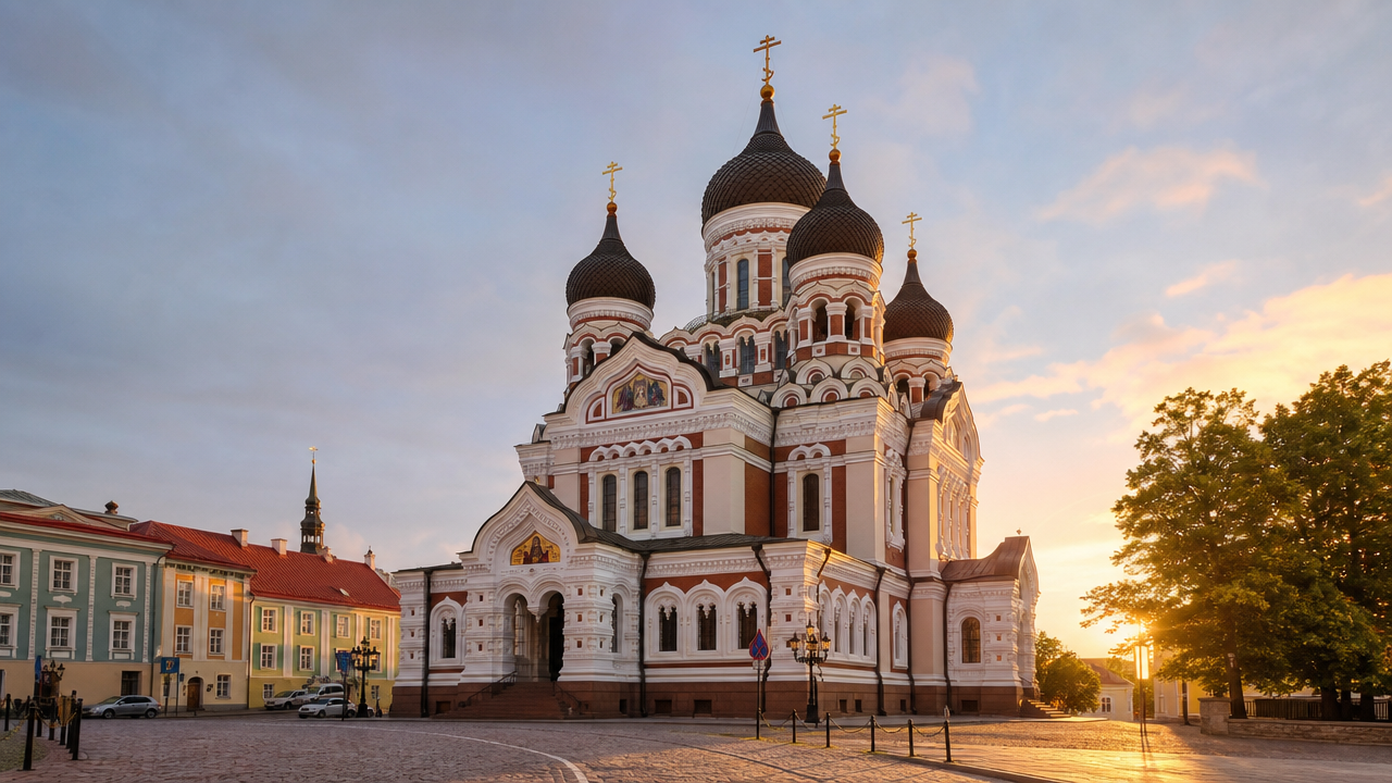
An orthodox cathedral known for its onion domes and intricate mosaic work. It is located directly across from the castle.
Visit early to capture the morning light on the domes.
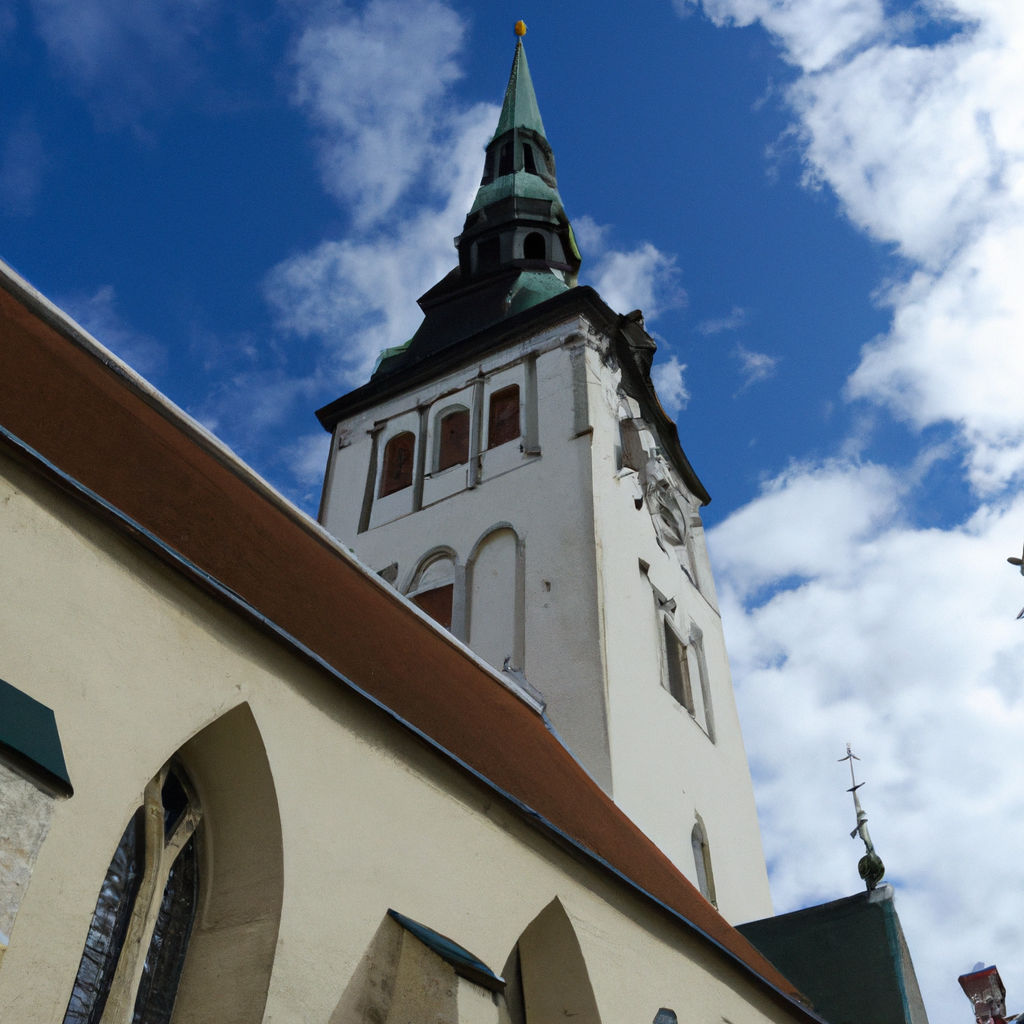
Historically one of the tallest buildings in the world, this church offers distinctive gothic architecture. Its spire remains a prominent feature of the skyline.
Look up from Pikk street to appreciate the full height.
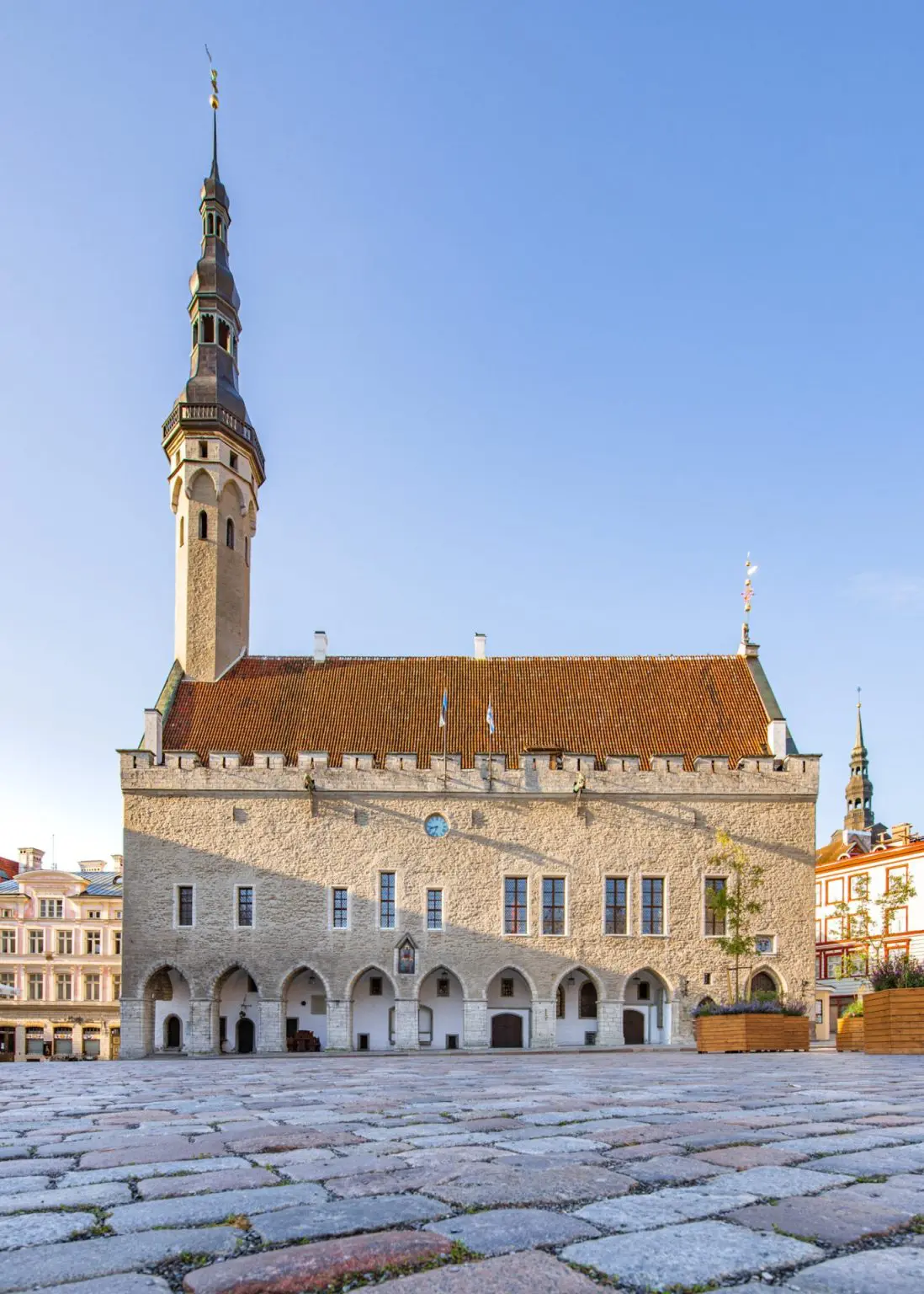
The central hub of the Lower Town, featuring the gothic Tallinn Town Hall and surrounding merchant houses. It has functioned as a marketplace for centuries.
Stand in the center to view the surrounding merchant facades.
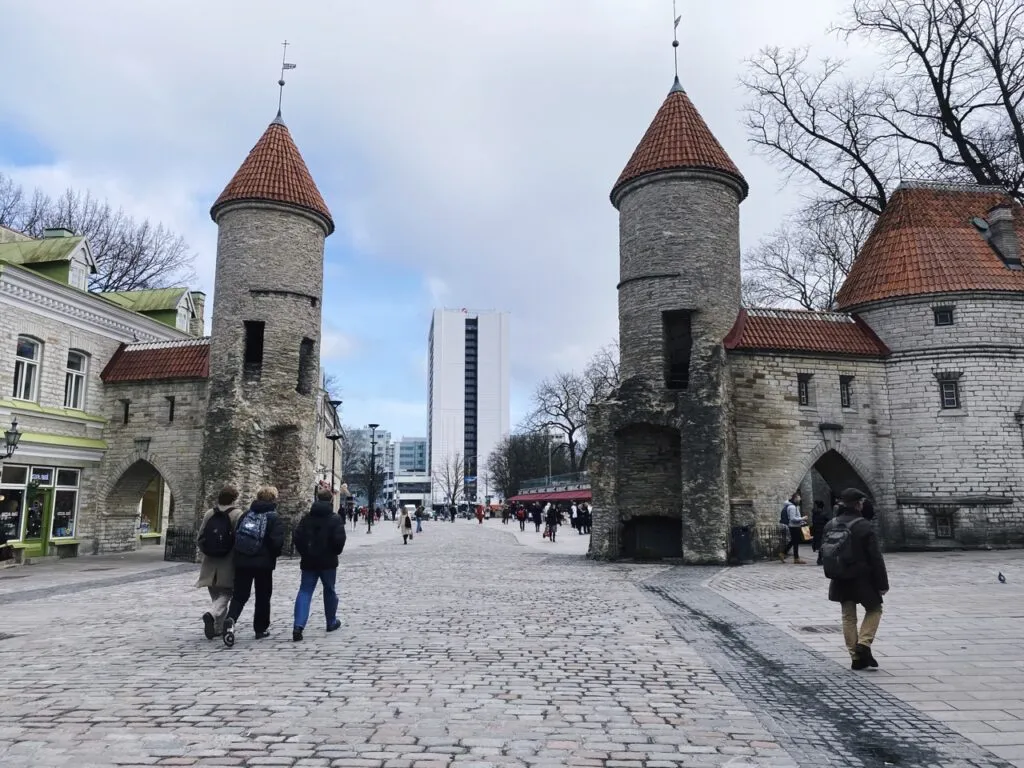
These ivy-covered stone towers are the remaining entrance to the medieval city. They mark the transition between the modern city and the old town walls.
Walk through the towers for a classic entry perspective.
Everything you need to know about tallinn walking tour map pdf
You can download the official tallinn walking tour map pdf directly from the visitor centre website to assist with your navigation. This resource helps you organize your path through the cobblestone streets and medieval architecture.
The information centre provides free access to visitors, meaning the entry fee is 0 EUR. You can visit the location at Niguliste 2 to collect additional materials or ask questions.
We recommend arriving between 09:00–17:00 to avoid the largest afternoon crowds. Following this advice ensures you have ample time to explore the city fortifications and UNESCO heritage sites at a comfortable pace.
Yes, many travelers prefer to print a tallinn walking tour map pdf before arrival to keep their route handy. Having a physical copy allows you to mark specific points of interest like Toompea Hill or the Town Hall Square.
Your tallinn walking tour map pdf acts as a navigation tool for exploring the winding alleys of the Old Town. Use it to identify key sights such as St. Nicholas Church and the city walls while managing your time effectively.
No booking is required to access or download the informational map resources. These assets are provided to help you plan your independent exploration of the Estonian capital at your own convenience.
The centre is open Monday through Sunday from 09:00–18:00. This consistent schedule makes it easy to stop by and gather information regardless of which day you arrive.
You can find comprehensive guides to Tallinn landmarks on the official visitor portal. These documents are designed to support your self-guided discovery of the city's rich history and architectural features.